
KANG YATSE 1 TREK EXPEDITION
Ladakh
Rated 4.9/5.0 on TripAdvisor. 550 Reviews
572 Reviews (5.0)
Rated 5 out of 5

572 Reviews (5.0)
Rated 5 out of 5
Key Highlights
- Altitude : 6400 mts
- Time : 14 Days - 13 Nights
- Region: Ladakh
- Best Time: July, September
- Distance: 70 Kms
- Grade: Moderate
Overview
Kang Yatse 1 Trek Expedition
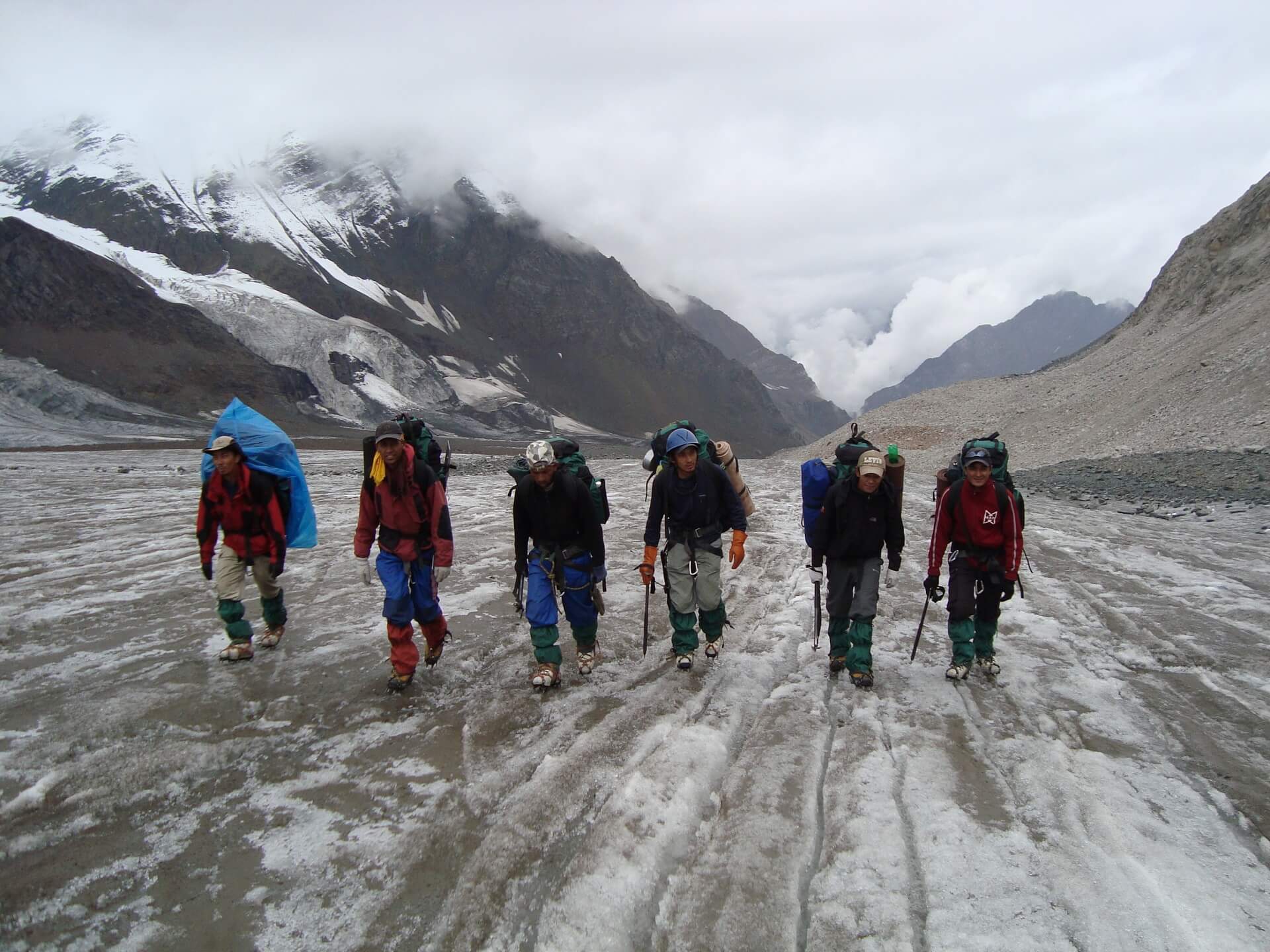
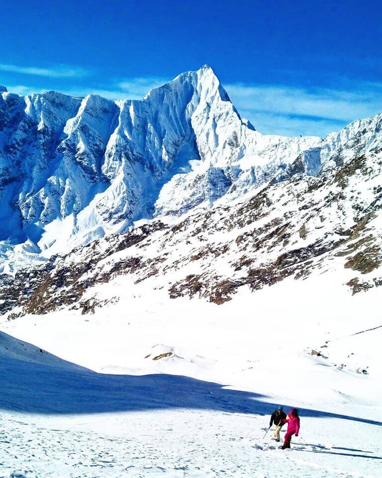
Hemis National Park, in the northern part of Ladakh, is where you'll find Kang Yatse I peak, along the famous Markha Valley path. At a height of almost 6400m, it is the tallest of the Kang Yatse Peaks located to the east. and the western ridge is where the smaller peak, at 6270m, rises. There are tricky approaches, raging river crossings, scree sections, knife edge traverses, and finally the plateau summit. Basic mountaineering skills, including the ability to ascend snowy slopes and tolerate high elevations, are required for Kang Yatse I. There are two main ways up the mountain, and choosing one will depend on how well you acclimatise. First, there's a moderate route that starts from Chilling and goes through the frequent Markha valley, passing via Skiu Markha and Hanker. From Shang Sumdo, one may take a different path that ascends sharply to the Markha gorge before reaching Larsa, Gongmaru la (5130m), and finally Nimaling. This path is quicker than the previous one up to 5,000 metres in height. needing one to adjust more rapidly. It will be up to the group leader and how well the climbers have acclimated to the altitude to decide which route to follow.
However the first path from Skiu is the most popular and has been used by locals for years. The walk up to the magnificent peak passes through a scenery that is representative of the variety seen across the area. Markha valley's harsh sunshine shifts periodically to reveal lush foliage adorned with a wide variety of highland flora and animals. The walk begins on abandoned surfaces after leaving the final road head at Chilling and following the Markha river.
It's possible to see animals roaming the area along the way. After an afternoon walk, we'll arrive at our first camping site in Skiu, and the next day we'll begin our trip to the settlement of Markha. Crossing some of the valley's coldest rivers on the way to the most populous settlement, Markha, is the day's only challenge. The next day's walk to Hanker will be a breeze and will take you through the historic Yensa monastery, which is set on a nearby cliff. The route then turns upward, and after many hours of ascent, we finally arrive at Base camp. The Kang Yatse Peaks are seen from base camp. The next day, move everything to the forward base camp and then go back to the main camp. The other day, you'll set up ABC (5900m) and be ready to make an assault on the peak. The summit attempt will take place in the dead of night, as climbers traverse scree, ice, snow, and steep slopes to reach the peak. Climbing safely over snow is impossible without ropes and other specialised equipment. The latter part of the climb tests your limits at terrifying altitudes. After several hours of hard work, we reach the top of the last hill, which has a sharp decline on all sides. At an elevation of 6,400 metres, Kang Yatse I has a fairly sloping top. The summit is breathtaking, with expansive sandy plains and mountain peaks enhancing the setting. And if the weather cooperates, the whole panorama may be gawked at from above. We will retrace our steps and make our way closer to the ABC, BC, and so on camps after being captivated by the beauty of Kang Yatse I's peak, but were forced to turn around because of bad weather. At long last, civilised society appears, bearing happy, healthy people who have found the genuine courage to conquer adversity. In only a few days, a trip up Kang Yatse I allows you to experience the full thrill of summiting a mountain, the pride of overcoming a formidable height, and the thrill of the adventurous life. Thus, we cordially encourage you to join their ranks and experience the wonders of Nature firsthand. Visit ancient forts and peaceful monasteries, walk through valleys and hills, and see animals all amid the pristine beauty of nature. Along the journey, you'll pass through some gorgeous flowering meadows that will wow even the most ardent hikers.
Cost Per Person
Key Highlights
- Altitude : 6400 mts
- Time : 14 Days - 13 Nights
- Region: Ladakh
- Best Time: July, September
- Distance: 70 Kms
- Grade: Moderate
Complete
Itinerary of Expedition
The journey begins in Leh, which serves as a gateway to the province of Ladakh and is surrounded by some of the region's most impressive mountain ranges. It is also a highly popular tourist location, and as a result, it is not too difficult to get there. This article, titled "Travel alternatives from near Leh," may be helpful to you if you are looking for directions on how to travel to this high-altitude centre for climbing. The first day of the expedition is set aside for the mountaineers to travel to Leh and get settled into their accommodations there. While the climbers will be starting at sea level, it will take some time for the body to adjust to the mountain air and become comfortable at the higher altitude.
The second day is set out for relaxing and getting used to the higher altitude, as well. It is essential that you do this so that your body can adjust to its new surroundings and lower the risk of developing any unfavourable health concerns. You may walk about and investigate the local market, immerse yourself in the vibrant colours and vibrant culture of this mountain city, and go to some of the neighbouring attractions. Acclimatization would benefit by having a little bit of freedom to wander about the city. You should also take advantage of this time to go over your checklist and do any last-minute shopping to ensure that you have everything you need for the trip. The greatest market for hiking necessities may be found in Leh. We make use of this time to get together with the group for a briefing session, during which we get to know each other better and delve into the happenings of the next few days, including the schedule, what to expect, basic dos and don'ts in the mountains, how to maintain the sanctity of the environment, and other such issues of significance. While the body acclimatises, we take advantage of this time to get together with the group.
Distance: 35 kilometres
Time Taken: 3 hour travel
The journey from Leh to Skiu provides us with the ideal opportunity to get acquainted with the landscape that we will be traversing for the next several days. Between 10:30 and 11:00 in the morning, we get up and go off for the day. This allows us to arrive at the campground in time to put up our tents, eat a nice meal, and begin to acclimatise ourselves to this new environment. The ride is really comfortable. Over an hour and a half later, after passing across a dismal and featureless plain beside the river Indus, we arrive at the point where the Indus meets the Zanskar River, which is easily distinguished by its peculiar colour. During this relatively short drive, we see rocky mountains in a wide variety of configurations, including slabs of rock piled neatly on top of each other, chunks of rock resting on each other in a haphazard manner, sheets of rock tightly pressed into each other, loose rocks, mountains made of mud, and many other types of rocky terrain. The overall arrangement gives the impression of the creator's experimental playfield of forms, where he dumped all of the many variations of his clay models that were deemed unsuccessful. We have passed through some of the driest terrain you will see on this trip, and we should arrive at the campground in time for lunch. This is one of the numerous dispersed and little hamlets that are spread out over the region, which gives it a little bit of greenery in comparison to all of the fields that the residents work. The verdant landscape is a sight for sore eyes due to its youthful appearance. After the completion of lunch and the setting up of our tent, we will go on a short acclimatisation hike in the early evening. This is of the utmost significance since it is a new environment, and the body needs time to adjust to its new surroundings. Always be sure to have a bottle of water with you everywhere you go. You won't have to wait long before you discover that the climate here is somewhat unusual, since it is exceedingly hot, highly dry, and extreme desert conditions. The heat causes you to become dry and brittle, and it is possible that your throat will feel parched. On the other hand, this is typical. Let your body take some time to readjust before continuing.
Distance: 11 kilometres
Time Taken: 6 hours
When you first arrived in Ladakh, the first thing you probably noticed was that the air was exceedingly dry. The unrelenting heat of the sun, which the land is exposed to for the whole of each day, is likely to have left your face and throat feeling irritated and itchy, respectively. The arid sensation extends all the way across the Marka valley. Imagine having to trek in the scorching sun over vast, open regions where there is no relief from the heat and being surrounded by mountains that seem like they are on the verge of collapsing at any moment; these people aren't doing it out of the kindness of their hearts, that's for sure! The Markha valley hike takes you through a culture of muck, heat, and a beauty that defies description in its own unique way. Since it is going to be such a long day, we get up as early as we can. We have an early morning yoga practice followed by breakfast, and then we break camp and go in the direction of Markha Village about 8:30 in the morning. The mornings in this terrain have a tendency to be a bit on the cool side, so be sure to dress appropriately and bring appropriate layers. Today's walk is a breeze; the route is almost all straight, although there are a few spots that go upward. The jagged rocky peaks, the poplar trees, and the muddy route appear to be a continual scene that we travel through for five days in order to reach to the camp of Kang Yatse I, which is silent and quiet. The only thing that resembles movement in this otherwise motionless environment is the river, which can be seen winding its way along the bed of the valley in flowing cascades. It is shimmering silver in the brilliant and harsh sunlight. After a total of two and a half hours of hiking, we reach a little wooden bridge that stretches over a swiftly moving murky creek. From that point, we travel for another hour to get to Sara, which is our last goal for the day. The majority of the path consists of unpaved roads and the rugged sea floor.
Distance: 10 kilometres
Time Taken: 5 hours
We pick up where we left off yesterday and proceed down the path in the direction of Markha Village, which is the biggest settlement in the valley with more than 40 individual homes. The path gains 300 metres in altitude over a distance of 10 kilometres, making for a manageable hiking day. Due to the fact that the geography has not changed from the previous day, it is now much simpler to cover the ground as it is already known to you. We make it back to the campground in time for a sizzling meal. We are going for an acclimatisation walk in the evening after we have finished putting up our campers at this campground, which is located in the middle of lush green grass and has a background of bleak mountains. The remainder of the day will be spent wandering about the location and giving our tired bodies a chance to relax.
Distance: 11 kilometres
Time Taken: 6 hours trip
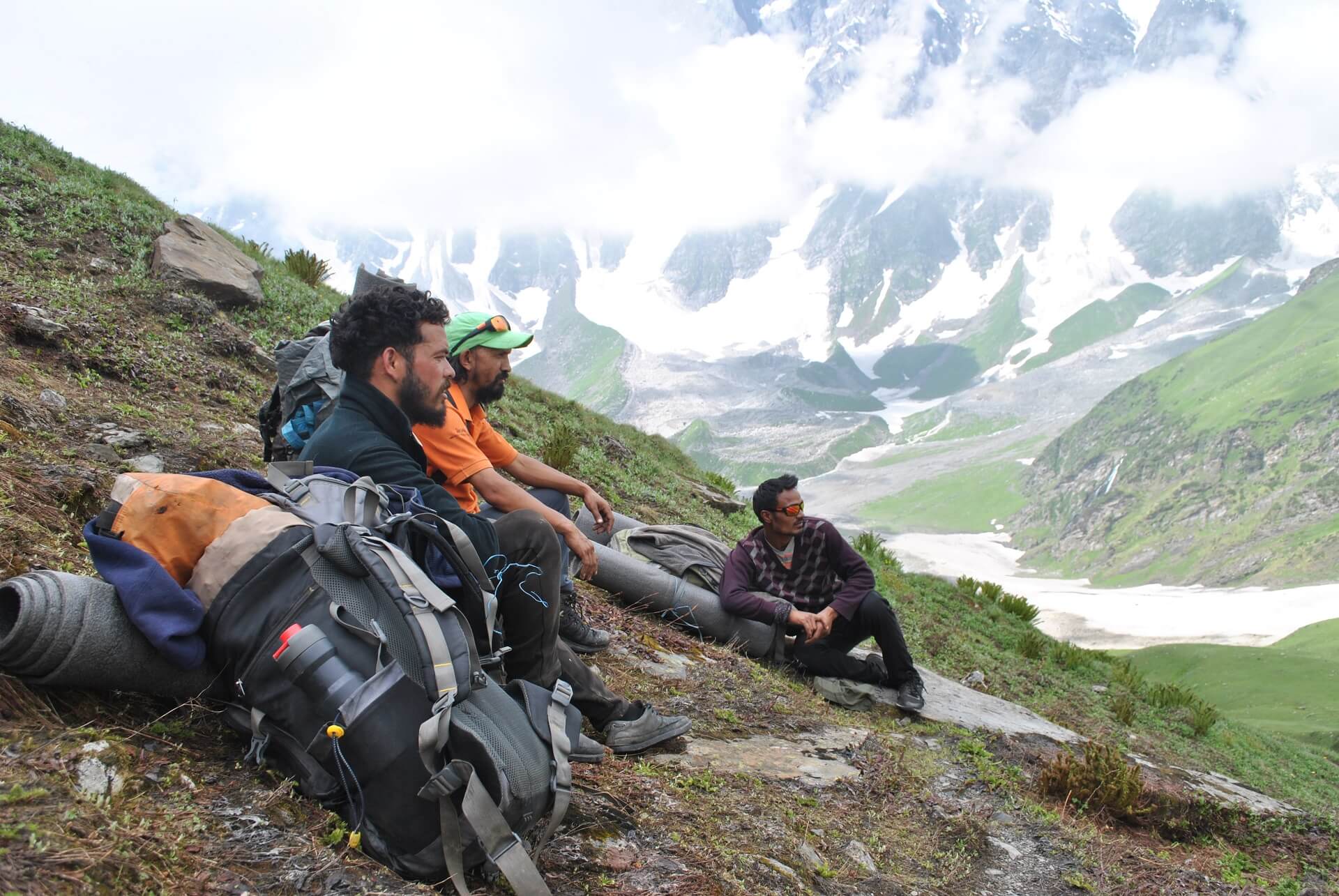
We are making the same amount of progress today as we did the day before. Long stretches of very flat countryside are interspersed with a few gentle hills and valleys throughout the path. The topography is mostly unchanged. In a manner identical to how Day 4 began, Day 5 will get underway at 8:30 in the morning. After walking for an hour, we approach the first river crossing that we will need to make. The heights of the water here are notoriously difficult to forecast. Depending on how high the water is, you will either have to wade in current that is up to your waist or hop, skip, and leap over the stream to get to the other side. After an hour of having crossed the river, we had arrived at Tacha Gompa, a monastery that is perched high on a precipitous slope and is clad in mud while perched on top of a mountain covered in mud. After another hour, we make our way up a short stretch of gradual ascent that leads to a canteen in a nearby hamlet, where we take a well-deserved break and have some refreshments. At this location, our day's destination is a campground that is a two-hour walk away. After walking for an hour, we got our first glimpse of Lower Hunkar. There is a clearing where big shrubs come to an end, and the landscape opens out to provide vistas of mountains that blend into one another. As you reach this point, you will begin to climb a bit higher away from the river bed. Even though the route does not have an uneven surface, which may lead to moments of boredom, continually putting your feet in cold water has a way of bringing your focus back to the task at hand. We pitched our tents smack dab in the centre of a field of wheat. In the backdrop, distant towns with homes lined up at great distances from one another keep watch around the tents. During the second half of the day, when we go on our stroll to become acclimated, there is a lot to discover in and around Hunkar. You won't be able to find anything to grumble about during this stroll!
Distance: 8-9 kilometres
Timing: between 6-7 hours
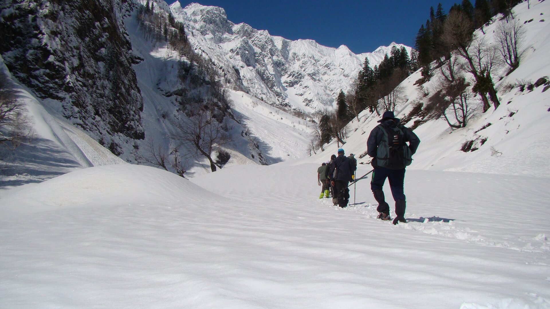
Sitting in the middle of a cool morning and watching the sunlight slowly creep towards you like it is taunting you is one of the most beautiful views. To see it slowly crawl to you as if it is teasing you is one of the best feelings ever. We are going to be climbing quite a little higher today, and we also have a lot of distance to cover, so we get an early start just like we have on all of our other days. Before 8:30 in the morning, we break camp by dismantling our tents and moving on. Upper Hunkar is a little hamlet with buildings tucked right in the heart of beautiful green fields that are fringed with flowers, and we will reach there after a steep rise that lasts for fifteen minutes and results in an elevation gain of one hundred metres. The usually monochromatic colour scheme is broken up visually by the presence of colourful prayer flags, which are displayed in every single settlement in this valley. Moreover, sacred rocks known as Mani stones may be seen in each community as well as along the path that connects all of the communities. They are stone plates and boulders that have Buddhist mantras carved into them; they contribute to the one-of-a-kind atmosphere of the valley. As an act of worship and respect for the local spirit inhabitants, mani stones are often arranged in the shape of a mound or laid out as individual offerings along highways and waterways. As a continuation of their belief that the universe revolves in a clockwise direction forming circular patterns, which are seen as a repetitive pattern in all Buddhist customs, the locals' beliefs dictate that these structures be crossed from the left. This is because circular patterns are seen as a repetitive pattern in all Buddhist customs. The fields in each settlement create strange geometric patterns, which contribute to the overall unusual appearance of the location as a whole. To get to the opposite side, we do a loop around the settlement of Upper Hunkar and then take a left turn into the valley, heading in the direction of the side where you can first view Kang Yatse. Down the riverbank, we continue our journey on the rocks and stones. During the next hour, we will leave the bank of the river and begin a difficult ascent up a muddy mountain. This will take around two hours. The mountains in this area have the appearance of being made of cardboard; they are strong, but they are warped and twisted in odd places, and they seem ready to collapse at the slightest touch. There isn't much of a rush elsewhere in the valley, with the exception of that one cloud that seems to be wandering aimlessly in an otherwise clear sky. Every blind bend reveals a fresh vista harbouring new mysteries that are waiting to be unearthed, while yellow and pink flowers give another layer of contrast to the chiaroscuro effect. After half an hour of starting the climb, we arrive at a brief section of descending terrain that leads to a bridge that must be traversed to reach the other bank of the river. Our stopping place is a deserted campground at an elevation of 4,195 metres, where we replenish our water supply at a spring of pure water and relax for a while in one of the ruined stone buildings. The river is already in our rearview mirror as we continue on. From this point on, we will continue our ascent, which will be slow and steady all the way up to Twin Lake. From where we are now sleeping, it will take us three hours to reach our destination. The greatest views of Kang Yatse I and Kang Yatse II can be found at Twin Lake, which also has a Buddha statue in the centre of the still water of the lake and prayer flags along the shores of the lake. The area immediately next to the lake has a tiny enclosure that serves as a place of prayer. The path leading out from the lake branches off into two distinct directions: one leads down into Nimaling, while the other leads to the base camp of Kang Yatse I. At this point, we turn to the right and continue on our way to the base camp. We should be at the base camp in little under two hours if all goes according to plan. We decided to call it a day here, so we set up our campers.
Distance: 4-5 km
Time Taken: 6-7 hours
Expeditions often use the approach of making rotation rounds between camps in order to better acclimatise to the environment. This is because high-altitude climbs need a rigorous acclimatisation schedule in order to be successful. In accordance with the maxim "climb high, sleep low," which is a tried and true guideline for avoiding hypoxia at that elevation, we move our campsites numerous times during the day. As we make our way to the Advanced Base Camp, we will be carrying our gear with us. We make our way back down to base camp in order to spend the night there. The ascent from Normal Base Camp to Advanced Base Camp is not very difficult, but it does require traversing some dangerous parts of scree and glaciers.
Distance: 4-5 km
Time Taken: 6-7 hours
We make our way back up to the Advanced Base Camp, but this time it's to take up residence at one of the campsites there.
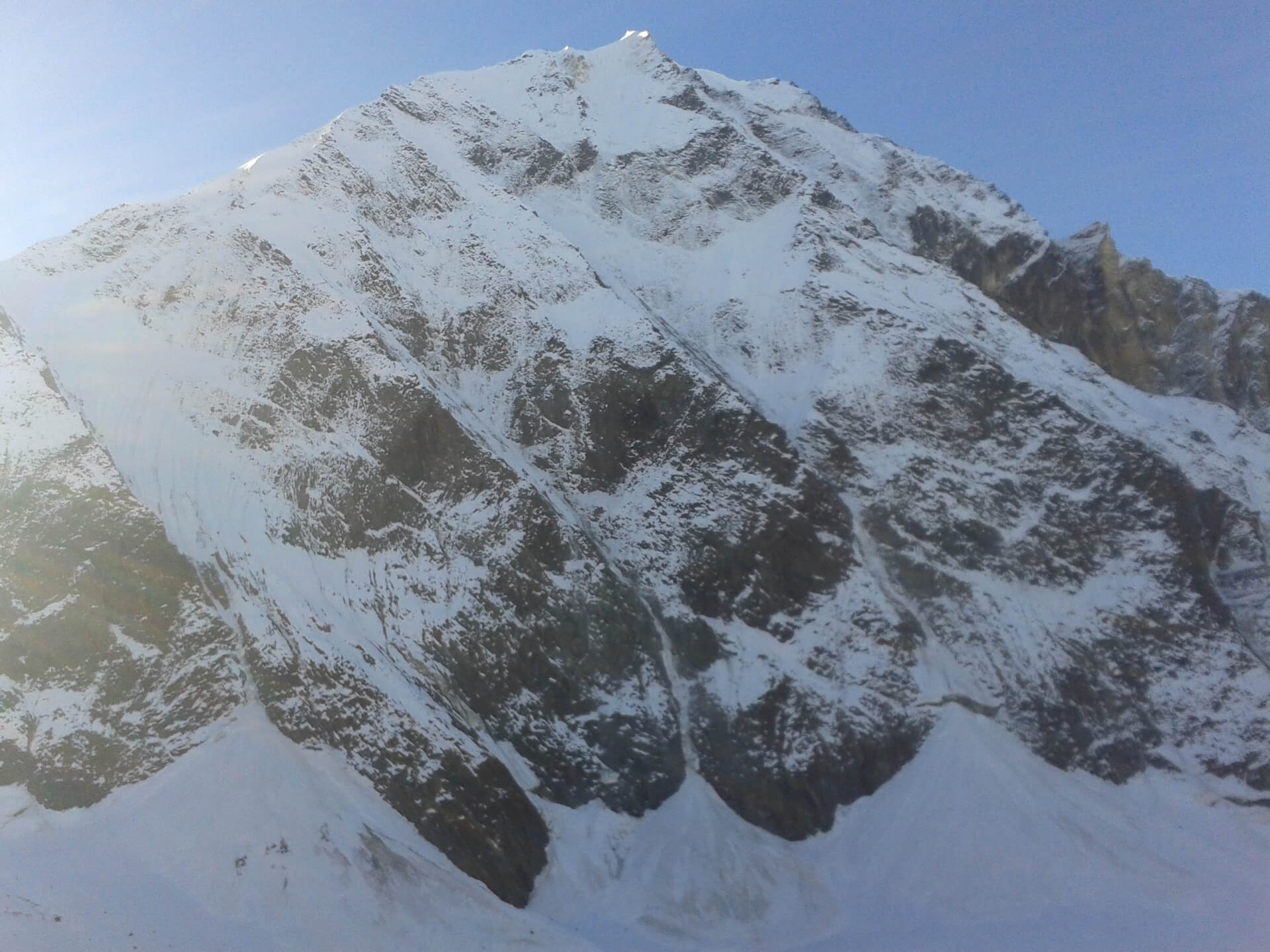
This is THE day. After midnight, we drag ourselves away from the comfort of our tents and begin the ascent towards the peak. After leaving Advanced Base Camp, the trail enters its more difficult section. It thrusts you headfirst onto steep slopes at a high grade and pushes you forward. It is possible that anchoring ropes will be necessary to cross the snow, however this will depend on the current snow conditions. The ascent requires the climber to negotiate difficult terrain, including steep portions, ice walls, and knife ridges that have a precipitous drop on both sides. The last 500 metres are the most difficult and entail ascending a nearly vertical ice wall using fixed ropes. This is the most difficult part of the climb. The view from the peak is very breathtaking, taking in all of the surrounding mountain ranges. We take a minute to relish the accomplishment of reaching the summit before beginning the equally arduous journey back to base camp. It is going to be a long and strenuous day, and it is important to use prudence when climbing higher and while descending lower.
We roll up our sleeping bags and go towards Nimaling, where we will spend the night at the inn there.
Distance: 15 kilometres
Time Taken: 8 hours hike + 3 hour travel
After a brief and relaxing day yesterday, we have a significant distance to go before we reach Chokdo, which is the starting point of the route that leads to Leh. We begin our ascent of the mountain on the other side of the valley from Nimaling. While the clouds move erratically in every direction, the light seems to be flushing a variety of reds, from a pale pink to a vibrant orange. The snow that is found on the peaks is illuminated by the sunshine, which adds to the dramatic quality of the surrounding area. When the numerous animals, in their morning splendour, are romancing the ground below, the river at Nimaling rushes from the meadows towards the mountains. On this particular day, there are no potentially hazardous areas, yet the task is nonetheless difficult due to the distance and the arid landscape. The ascent to the Kongmaru La pass consists of a few spots of steep inclination interspersed with extensive expanses of flat ground that are abundant with pikus and marmots. After travelling from the foot of the mountain to the bottom of the pass, which takes us three and a half hours, we must then climb steadily for another half an hour to reach the summit of the pass. The pass offers some of the most breathtaking views of Kang Yatse 1 and 2, in addition to Dzo Jongo. On the pass, which is decorated with prayer flags, there is a strong wind. The locals come up here rather regularly to make phone calls since this location has access to high-speed internet and a robust phone network, neither of which are available five steps farther on either side of the pass. The distance between Nimaling and this location is little under 2 kilometres. After leaving the pass, the only option is to descend down a narrow path, passing through gorges and fording water, with the valley continuously appearing and vanishing around every bend. There are geological formations with gigantic walls rising vertically on each side of you, and the surge of water filling up these small tunnels with the oddest and most intriguing fauna you will ever see. The landscape is remarkable in its colours, with rocks spanning the colour pallet. To get to the final point of Chokdo, which is where we start the three-hour trip to Leh, we have to traverse this part, which takes 3.5 hours and involves going up, down, sideways, and in every other direction you can think of. Anticipate arriving in Leh sometime in the late evening.
Day 13 is set aside for a potential second summit attempt in the event that adverse conditions or other challenges arise. This will only be used in the case if unanticipated and unforeseen circumstances show themselves at the very last minute, preventing the first summit push from taking place.
The journey comes to an end here, but not before some festivities. How are we going to wrap up this exciting journey if we don't have a summit party? If you want to remain in Ladakh for a few more days to explore its charms, the article that follows may help you get started on deciding where you want to go and what you want to see. (Places of interest to see in Leh and Ladakh) As was said before, the climate at high altitude, in addition to a great number of other factors, is very unpredictable. It is our recommendation that you schedule some time off between the conclusion of the trip and the beginning of your travels to go back home after the adventure.
Enquiry For Group Bookings
Guidelines
➽ Preparation for Expedition
During the wonderful Himalayan trek, mind, body, and spirit must all be overcome, as you well know. Precise preparation, with appropriate pliability of observing and confronting circumstances, is essential. Due to the difficulty and unpredictability of expeditions, participation is limited to those who have completed trekking at altitudes of at least 4,500 metres at least four to five times or have finished a Basic Mountaineering course.
The following are some considerations for the Kang Yatse 1 Trek Expedition:
⦿ Physically – An Expedition requires a lot of physical endurance, therefore you should start working out a month before signing up for a programme. Strengthen your legs by jogging and working out regularly to increase your stamina. To better acclimatise to the environment and increase your resilience on the walk, you should give up smoking and undertake breathing exercises twice a day. Participate wholeheartedly in sports, Yoga, and other cardiovascular activities. Sometimes you have to climb for 20 hours straight, therefore you need to be ready to push yourself to the maximum, which is only possible with well-defined pre- and post-climb training.
⦿ Mentally – As essential as physical training is for an Expedition, so too is mental preparation. Relax, enjoy your regular activities, and take care of yourself before embarking on an Adventure. Don't put yourself through mental anguish by making guesses or planning ahead for the Expedition. Get together with your closest pals to rejuvenate and refocus your thinking. After you join the March and meet the rest of the pack, you will find encouragement and excitement, proving that your pre-expedition preconceptions were unfounded. As you endure the hardships of the journey, both your mental and physical toughness will increase. Hence, as you make your way up to each campground, it's a good idea to pay attention to different sections of the body and actively relax them. Focus on the path or whatever perilous terrain you must carefully handle when climbing, and attempt to relax your body. Try out a few new walking techniques to add some fun to your commute that has nothing to do with getting anywhere. The best way to keep one's mind in good shape when traveling is to relax and enjoy the ride.
⦿ Technically –
Choose the right size of trekking or climbing shoes and walk with it, from a technical standpoint. Fill a 60-liter container. Carry as much as you can in your rucksack on a regular basis to become accustomed to walking lengthy distances with it. You should equip yourself with a trekking pole, water bottle, warm socks, thermals, fleece, feather jackets, cap, trousers, poncho, flip flops, and any necessary equipment like a power bank and camera (DSLR or digital camera). Get a sling and use it to perfect the primary knots you'll need for the ascent.
The rewards of a successful mountain ascent are well worth the effort required to reach the top, which may be as daunting as the mountain itself. The Himalayan Adventure Tours Expedition to Mighty Mountain Kang Yatse awaits your honest participation.
Guidelines
➽ Things to Carry
- T-shirts
- Trekking Pants, Lowers that are thick and heated
- Windproof jacket, Jacket stuffed with down, ideally one that has a hood
- Fleece, which is warm and dense.
- Sweater made of wool with full sleeves
- Thermoregulating undergarments (upper & lower).
- Accessories made of wool, including a woollen hat, woollen gloves, woollen socks, and ordinary socks (3-4 pairs).
- a Balaclava, a woollen hat, or a scarf or silencer (the latter two are optional).
- Comfy Trekking/Hiking shoes (shoes with a thick sole are recommended).
- Towel with a Low Weight (1 unit).
- Toilet Paper (plenty).
- Wet-Tissue Papers (plenty).
- Floaters, sandals, or slippers that are not too heavy
- Poncho or raincoat, etc. Towel of a small size and low weight.
- a container for water.
- Sunscreen Lotion.
- Use a cap to shield the harsh rays of the sun from your face, Sunglasses.
- Stick or Trekking Pole, Head Torch or Headlamp, and Walking Stick or Trekking Pole (with extra batteries).
- Medications (if required any specific drug) (if requiring any particular medication).
- Personal hygiene products.
- You should have a day pack or another compact backpack that you can sling over your shoulder and carry with you wherever you go.
- A camera with its batteries fully charged.
Guidelines
➽ How to Reach
Travel time and distance by road:
You will begin your journey in Delhi, and then go to Karnal, Mandi, Manali, Jispa (through Rohtang Pass), Sarchu, and Tanglang La before finally arriving in Leh, which is your final destination.
Distance: 1011 kilometres (approx.)
Airports in Closest Proximity:
The most convenient method of travel is flying. Delhi is the central destination. There is just one flight every day that departs from Delhi and lands in Leh. There are three airlines that provide flight services between New Delhi and Leh: Jet Airways, Air India, and Go Air. Since prices tend to go up after a certain amount of time has passed, it is in your best interest to make your reservations as far in advance as possible. It is almost hard to go by road since the surrounding mountains are covered with snow. Flight is by far the most popular option.
➽ Trip Cost Includes
- Mountaineering (Instructor/guide) services provided by a highly trained, professional, and qualified Himalayan Adventure Trips staff.
- Certified local guide with extensive familiarity of the area.
- Climbing provides only vegetarian food (breakfast, lunch, and dinner).
- Staff include chefs, cooks, and helpers.
- High Altitude Force, Low Altitude Force, Porters, Mules for Common Equipment (Rations, Tents, Utensils, Central Climbing Equipment, etc.)
- Tents (to be shared), sleeping bags, air mattresses, and air pads are included. Inner
- We offer twin-share accommodations in dome, alpine, and high-altitude tents on all of our treks and expeditions. All necessary camping equipment, including air mattresses, a shelter for cooking and eating, a table and chairs, a stool, and more, would be supplied.
- Someone who can carry heavy items, set up high camps, repair ropes, etc. at high altitudes.
- Assistance from Guide All the Way to the Top
- High-altitude butane gas cooker
- The only meal offered at the hotel will be breakfast. All meals while on the walk will be supplied for you. Indian, Chinese, and Continental cuisines, all freshly cooked, will be on the menu.
- Tin-packaged food is what we'll eat at high altitude.
- A standard first aid kit with oxygen masks for the patient.
- Camping fees, wildlife fees, and forest permits.
- Taxes imposed by the state.
➽ Trip cost Excludes
- Climbers may hire individual porters to carry their gear.
- Airport transportation costs
- Expenses for carrying still/video cameras etc.
- Irregular/Personal costs, such as laundry, phone calls, and gratuities.
- Climbing equipment such as ropes, pitons, snow bars, crabs, etc.
- Your own personal mountaineering equipment and clothes, as well as any specialised foods you may need
- Inner Line Permit.
- Health coverage or the price of a rescue mission
- Expenditures of a more personal character (such as booze, soda, bottled water, mineral water, canned or bottled drinks, candy, canned or packaged dried fruits, etc.)
- Provisions/food to or from the starting point of the trek.
- Any expenses that are incurred as a result of natural disasters, human error, or other unforeseeable occurrences.
- Protect your trip with a travel insurance policy.
- Authorization, licensing, and enlistment with the IMF.
- Payment for Liaison Officer (included for foreign expedition only)
- GST of 5%.
Guidelines
➽ Special Casual Leaves
Government employee can avail the benefit of special casual leave when u join us for a trekking expedition. As per the rule of the pay commission, special casual leave can be availed for up to 30 days in a calendar years for trekking and mountaineering expeditions through a register organization. Himalayan adventure trips are a register adventure tour operator register with Indian mountaineering foundation and Himachal Pradesh tourism. Candidates have to apply for leave at least 30 days before the trek/expedition start.
Testimonials
➽ Provided By The Customers
Climbing Hanuman Tibba in August 2019 with Good Company
In the company of Hat, Sameer, Arun, and I climbed to the summit of Hanuman Tibba (at an altitude of 5932 metres). With Shera at the helm as the chief guide, along come Vishal, Panna, and Jaggi, who work together to form a tight-knit, effective, and amiable unit. The majority of our time was spent in a high-quality 4-person tent; the given gear was not brand new but adequate, with the exception of a few small difficulties with one of the sleeping bags. Both the meal and the hot beverages were delicious. Manu was simple to get in touch with before to our adventure, and he answered all of our questions (there weren't many) thoroughly. Basically, my time spent on adventure with Himalayan Adventure Trips was both personally rewarding and professionally enriching.
Professor Atul Deokar, Ph.D.
How useful was this post?
Click on a star to rate it!
Average rating 0 / 5. Vote count: 0
No votes so far! Be the first to rate this post.
 (1)")

 (1)")

