Yunam Peak Expedition
Lahul, Himachal
Rated 4.9/5.0 on TripAdvisor. 550 Reviews


Key Highlights
- Altitude : 6110m./ 20045ft
- Time : 7 Days - 6 Nights
- Region: Manali / Lahul Spiti
- Best Time: June-October
- Grade: Easy
Overview
Yunam Peak Expedition
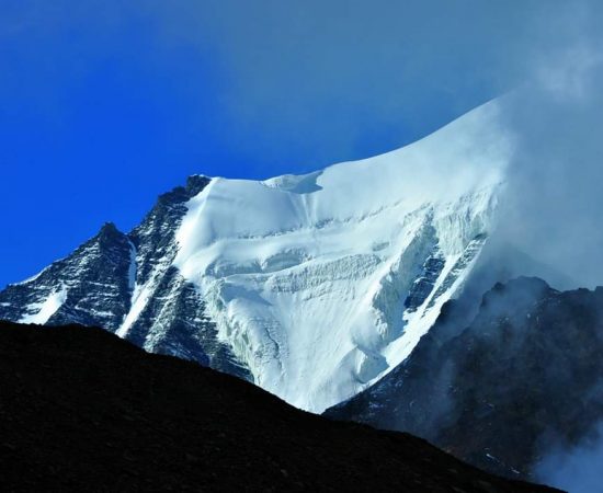
Yunam Peak, in the remote Lahaul area of Himachal Pradesh, is one of the lesser-known trekkable six-thousander summits in the state. Yunam mountain, which stands at an impressive 6111 meters above sea level, provides a breathtaking panorama from its top and is a must-see for any adventure traveller with prior high-altitude hiking expertise. Geographically, Yunam Peak is located in the Pir Panjal Range, which is a part of the Himalayas. The Pir Panjal Range runs parallel to the main Himalayan Range and separates the Kashmir Valley from the rest of India. The range is known for its rugged terrain, deep valleys, and high peaks. Yunam Peak is situated in the Lahaul and Spiti district, which is one of the most remote and least populated districts in Himachal Pradesh. The district is known for its barren landscape, high altitude villages, and ancient monasteries.
Tourists go from all over India to visit Bharatpur, the Base Camp for Yunam peak, because of its proximity to BaraLacha La, the highest motorable road in Himachal Pradesh. Yunam Peak was given its name by the expedition because the sacred Lake Yunam Chho was situated close to the peak's high camp. The distant position of Yunam peak is a major reason why it is not as well-known as other peaks in the area, such as Stok Kangri and Kang Yatse II, which are more regularly climbed. Nonetheless, because the Atal Tunnel is now complete and accessible to the public, adventurers and amateur mountaineers are gradually shifting their focus to Yunam Peak. The C.B. Range, Mulkila Range, and, on a clear day, the Zanskar Valley in Ladakh U.T., are all visible from the peak. Bharatpur, which is situated on the Manali and Keylong Highway, serves as the beginning point of the ascent and as the trek's base camp. Lahaul and Spiti valley's otherworldly environment will leave you with vivid memories for a lifetime.
Yunam Peak is named after the Yunam river, which originates from the nearby glacier and flows through the Spiti Valley. The peak has been known to the locals for centuries, and they consider it sacred. However, it was only in the 1970s that the peak gained popularity among mountaineers and trekkers. In 1973, an Indo-Japanese expedition led by Y. Miyake and D. D. Dangwal successfully climbed the peak, and since then, it has been a popular destination for mountaineering enthusiasts. Climbing Yunam Peak is a challenging but rewarding experience. The mountain requires a high level of physical fitness and technical climbing skills, as the ascent involves crossing crevasses, traversing steep icy slopes, and climbing through rocky terrain. The best time to climb the peak is from May to June and September to October when the weather is favorable and the skies are clear.
Cost Per Person
Key Highlights
- Altitude : 6110m./ 20045ft
- Time : 7 Days - 6 Nights
- Region: Manali / Lahul Spiti
- Best Time: June-October
- Grade: Easy
Complete
Itinerary of Expedition
Once you've reached Naggar, reach the allocated hotel. This information will be shared with you before your arrival in Naggar. Rapid altitude rise presents the most difficulty on Yunam Peak, thus it is essential to spend some time in Naggar and go about acclimatizing. The afternoon before your attempt to summit the huge Yunam Peak, your Trek Leader will provide you with a comprehensive orientation. There will be free time to explore Manali and pick up any necessities that you neglected to pack. Overnight stay in Hotel at Naggar
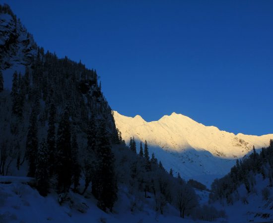
After a quick breakfast at the hotel, we'll be hitting the road and making our way from Manali into the dry, desert scenery of Lahaul. The time it takes to go to Jispa has been cut in half because of the Atal Tunnel. Once we emerge from the Atal Tunnel and reach the Lahaul valley, we'll go via the picturesque town of Sissu, known for its beautiful waterfalls and the nearby Raja Ghepan temple. So far, the environment has been a combination of green and semiarid, but as we climb higher, the vegetation will gradually vanish and be replaced by a dry, desert landscape. We'll also pass through picturesque Tandi, right on the confluence of two rivers that feed into the Chenab—the Chandra and the Bhaga. We'll continue on to Jispa and pitch our tents near a water supply in the afternoon. Our campsite is located near to Atal Bihari Vajpayee Institute of Mountaineering and Allied Sports. The location is close to the river so if you can take out some time and take a stroll near the river. In order to acclimatize to the altitude, which has increased by around 1,500 meters, we shall take a stroll after tea. Camp out at Jispa for the night.
In the morning, we'll set off on our journey to Bharatpur Base Camp, passing via Darcha, yet another picturesque settlement tucked away in the Lahaul valley. Since this route from Manali to Leh is so well-known among motorcyclists, it sees a large influx of visitors every year. Zing Zing Bar is the last settlement before reaching BaraLacha La. You'll have free time to explore Deepak Tal and Suraj and snap some photos, and we'll transport you there. Our plan is to drive over the highest motorable road in Himachal Pradesh, the Nala crossing in Bharatpur, and then pitch up tent near some Dhabas that are popular with bikers.The area full of army convoys who help support the Border Road Organisation. Repeat your acclimatization walk in the evening to help your body acclimate to the higher altitude. We'll be spending the night in Bharatpur Base Camp in tents.
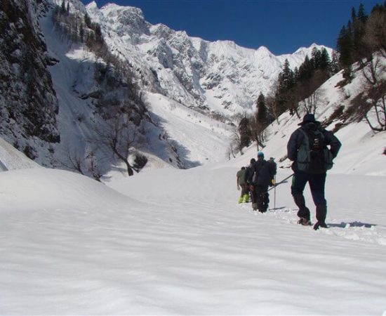
Getting to the Summit camp involves a kilometer and a half of tar road walking before we reach the spot where we begin ascending the mountain. Getting to the summit camp today requires a significant amount of elevation gain, so the path is rather steep for the most part. Climbing the mountain requires a lot of effort since the first section of the path is on dusty ground with rocks interspersed; your footing is never certain, and you may easily slide down the mountain by a few inches at a time. Atop a rocky outcrop, we'll pause for a moment to soak in the breathtaking panorama that has just opened before us. The whole valley and the Tsarap River are seen from here. The peak we'd be facing would be surrounded by a rainbow of hues, which will be a welcome sight. The next section is level and leads to a grassy plain. You may fill up your water bottles and maybe even see some marmots if you come here. The incline will get more steep over time. The last stretch to the summit camp is the most difficult because of the steep slope and the presence of loose rocks. On the other hand, the terrain levels off until you get to the campground. In order to lighten our weight for the following day, we will set up camp and store our rations and other goods there. After reaching the summit, we shall descend down to Bharatpur Base Camp through the same method. We'll be spending the night in Bharatpur Base Camp.
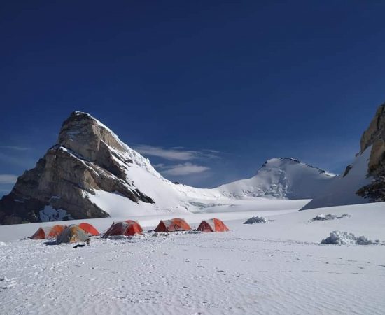
After a hearty breakfast at Base Camp, we'll go up to the higher elevations to set up the Summit Camp. The following morning, we'll go up the same trail we used the day before and bring the remainder of the supplies needed to make an attempt on the summit. Once we have acclimated to the altitude in the Summit camp, we want to explore the area around Lake Yunam Chho.
Today is the day we've all been waiting for. Our goal for today is to reach the top of Yunam Peak. There are around 6-7 kilometers and about a thousand meters of elevation gain between the summit camp and the peak itself. The day will put your resolve to the test in every way. You should also bring along 3–4 liters of water and some food that will provide you immediate energy so that you can continue the ascent. Scree and moraine make up the whole of the path to the peak, and their sharp, jagged rocks provide a formidable obstacle. A short chimney-like structure with loose rocks and a high gradient marks the beginning of the ascent. When we finally reach the apex of the chimney, the landscape will open up, and we'll be able to see the route to the peak. If you're feeling discouraged because the peak of Yunam Peak seems so far away, remind yourself that you can do it with some steady rhythmic breathing and a positive attitude. You should count your steps before stopping to rest on a six thousander. The massive amount of work needed to reach the peak may be tackled in manageable chunks using this method. There will be brief breaks along the way for us to stretch our legs, eat something to refuel, and drink some water. When you finally get it to the peak, the panorama is spectacular. Now that the sun has risen, we can see the C.B. Range and the Mulkila Range, both of which are covered with glaciers. Take pictures to remember the moment you reached the top of the world's largest mountain. Our first stop after descending from the peak will be the summit camp, where we'll pack up our belongings and prepare to leave for the Base Camp. The ascent will be accomplished by using the same path we used to get here. We'll spend the night in Base Camp after making it to the summit of Yunam Peak, to celebrate and rest our muscles.
Note: In case a group of people wish to leave for Manali after the summit attempt then arrangements for a vehicle can be made at extra cost
Following breakfast, we'll resume our road trip back to Manali, passing through the same breathtaking scenery on the way. This includes the aforementioned BaraLacha La, Jispa, and Sissu. Once we've reached Manali, our trip will be over, and everyone in the party will be able to look back on their experience of the peak with fondness.
Enquiry For Group Bookings
Guidelines
➽ Preparation for Expedition
As you know every mountainous excursion demands a precise planning, a planning with adequate pliability of observing and tackling situations, held all as by overcoming mind body and soul throughout the incredible Himalayan journey.
So here are some aspects regarding Yunam Peak Expedition preparation:
⦿ Physically – A trek demands physical endurance, to prepare for each trek you should work out a month before joining a program. Build up the adequate strength in your legs by running and exercising every day to boost up your endurance. Stop smoking and boost your lungs doing breathing exercises at routine basis two times a day, which will help acclimatize the conditions while being resilient on the trek. Take active part in outdoor games, Yoga and any other cardiac exercises.
⦿ Mentally – Mental preparation is key, equally as important as physical training requisite for a trek. Before joining any trek take pleasure in your daily routines, eat well, take rest properly and relax. Do not stress your mind by unnecessary predictions about the trek. Be with your best friends to get motivated and relax your mind. Because pre trek assumptions are not worthy because once you join the trek and meet with rest of the pack will bring encouragement and excitement. The mental preparedness will build through the entire trek conditions. And the physical drawbacks will affect the mind. So pay close attention to various parts of the body and consciously let them loosen up as you trek. When you trek try to relax your body, especially your hips. If you’re on a winding downhill trail or on a panicking slant, think of each step as part of a simple dance and enjoy the natural rhythms that the terrain and your body can find together cautiously. Experiment with different ways of walking as a way of finding enjoyment beyond the goal of reaching a destination. The main key to stay mentally fit is to enjoy the route and not to pressurize the mind.
Guidelines
➽ Things to Carry
- Good Trekking Boots: You need sturdy trekking boots with supportive high ankles. Don't bring your running shoes. U can carry extra floaters/flip flops also.
- Wear warm clothing, such three-layer coats, fleece upper, hollow fill or down-filled jackets. Carry full-sleeved T-shirt. Carry cotton hiking trek pants and warm pant for your lower body. Never bring shorts or jeans on a hike.
- Take top and bottom thermals with you.
- Quick dry towel with light weight and Personal toiletries. Suns cream lotion, sanitizer, tooth brush ad toothpaste, lip balm and antibacterial powder.
- Socks: Bring two pairs of regular socks and two pair of wool socks for wearing at night.
- A head torch is required.
- Sunglasses/ Goggle: UV-protected sunglasses are necessary to protect against sunlight and Snow Mountain.
- There should also be a woolen cap / balaclava, cap, neck gaiter cum face mask and warm fleece and waterproof summit gloves since it will be chilly. Keep waterproof gloves on hand since they become wet in the snow.
- Everyone taking part in the activity should have their own lunchbox, spoon, mug and water bottle/ hydration pack of 2 ltr.
- Raincoats/ponchos: Since snowfall and rain are frequent at high elevations, it is important to have one on hand so as to avoid getting wet.
- Trekking bag of 75 ltr with rain cover.
- Walking stick.
- Personal first aid box. Emergency ration, energy bars, dry fruit, electoral/Ors
- Personal technical gears list of mountaineering (on rent basis available)
- Climbing boot, Crampon, Sleeping bag (optional), Ice axe, seat harness, Rope and tape sling, helmet, Summit gloves, Gaiters, Carabineers 2 no (screw), figure of eight/descendor, Zumar (Ascendor),
- Required Documents:
a) Registration Form
b) Medical Certificate (signed by a licensed MBBS physician)
c) NOC form (completed by the trekker)
d) 2 passport-size photos
e) ID Proof photo (not PAN)
f) Basic Mountaineering Course certificate.
g) Insurance upto 5 lac..
Guidelines
➽ How to Reach
How to reach Manali:
Delhi and Manali are linked nicely. You may travel from Delhi to Manali in 12 to 14 hours via overnight bus (approx 540 KMS). Online ticket reservations are available at www.redbus.in and www.hrtc.gov.in Tip: Given the distance between Delhi and Manali, the majority of Volvo private buses depart Delhi between 5 and 8 p.m. At 8.30 p.m., the final government bus departs from ISBT Kashmere Gate. Between Rs. 1,200 and Rs. 1,800 are charged by Volvo buses each sector from Delhi to Manali and vice versa. Delhi to Manali: Buses depart from Manali for Delhi between 4 and 8 p.m., same like the return trip. You should expect to arrive in Delhi any time between six and ten in the morning. Plan your subsequent trips just after midday, leaving ample time for bus delays.
How to reach Naggar:
Naggar is 18 kilometres from Manali, and there are several buses that operate every 15 minutes. Alternatively, one may get out at Patlikuhal, which is 5 kilometres from Naggar on the right bank highway. Between Kullu and Manali is Patlikuhal. To get to Naggar, you may take a cab or a local bus from Manali or Patlikuhal.
The closest train station is:
Ambala (350 miles) and Chandigarh are the closest railway stations (310 kms). Advice: From Chandigarh to Manali, regular buses and Volvos run in the evening. Volvo buses from Chandigarh to Manali and vice versa charge between Rs. 800 and Rs. 1,200 every sector.
The closest airport:
The closest airport to Manali is Bhuntar, which is 52 kilometres distant. From Bhuntar to Manali, taxi services are available and cost between Rs. 1500 and Rs. 2,500. Air travel between Bhuntar and Delhi is convenient. Airlines providing flights from Delhi and Chandigarh to Kullu include Indian Airlines, Kingfisher Airlines, MDLR Airlines, and Jagson Airlines.
➽ Trip Cost Includes
- Mountaineering (Instructor/guide) services provided by a highly trained, professional, and qualified Himalayan Adventure Trips staff.
- Certified local guide with extensive familiarity of the area.
- Climbing provides only vegetarian food (breakfast, lunch, and dinner).
- Staff include chefs, cooks, and helpers.
- High Altitude Force, Low Altitude Force, Porters, Mules for Common Equipment (Rations, Tents, Utensils, Central Climbing Equipment, etc.)
- Tents (to be shared), sleeping bags, air mattresses, and air pads are included. Inner
- We offer twin-share accommodations in dome, alpine, and high-altitude tents on all of our treks and expeditions. All necessary camping equipment, including air mattresses, a shelter for cooking and eating, a table and chairs, a stool, and more, would be supplied.
- Someone who can carry heavy items, set up high camps, repair ropes, etc. at high altitudes.
- Assistance from Guide All the Way to the Top
- High-altitude butane gas cooker
- The only meal offered at the hotel will be breakfast. All meals while on the walk will be supplied for you. Indian, Chinese, and Continental cuisines, all freshly cooked, will be on the menu.
- Tin-packaged food is what we'll eat at high altitude.
- A standard first aid kit with oxygen masks for the patient.
- Camping fees, wildlife fees, and forest permits.
- Taxes imposed by the state.
- Climbing equipment such as ropes, pitons, snow bars, crabs, etc.
➽ Trip cost Excludes
- Climbers may hire individual porters to carry their gear.
- Airport transportation costs
- Expenses for carrying still/video cameras etc.
- Irregular/Personal costs, such as laundry, phone calls, and gratuities.
- Your own personal mountaineering equipment and clothes, as well as any specialised foods you may need
- Inner Line Permit.
- Health coverage or the price of a rescue mission
- Expenditures of a more personal character (such as booze, soda, bottled water, mineral water, canned or bottled drinks, candy, canned or packaged dried fruits, etc.)
- Provisions/food to or from the starting point of the trek.
- Any expenses that are incurred as a result of natural disasters, human error, or other unforeseeable occurrences.
- Protect your trip with a travel insurance policy.
- Authorization, licensing, and enlistment with the IMF.
- Payment for Liaison Officer (included for foreign expedition only)
- GST of 5%.
Guidelines
➽ Special Casual Leaves
Government employee can avail the benefit of special casual leave when u join us for a trekking expedition. As per the rule of the pay commission, special casual leave can be availed for up to 30 days in a calendar years for trekking and mountaineering expeditions through a register organization. Himalayan adventure trips are a register adventure tour operator register with Indian mountaineering foundation and Himachal Pradesh tourism. Candidates have to apply for leave at least 30 days before the trek/expedition start.
Read
➽ Frequently Asked Questions
Yunam Peak Expedition is situated in the Indian Himalayas of the Lahul Range, near Manali township, Himachal Pradesh, India.
About 6110 meters (120045.93 ft) above sea level.
The base camp for the Yunam Peak Expedition is Jispa, & you can reach there by road via Manali, and from there you have to do trekking.
The best time to undertake the Yunam Peak Expedition is typically during the summer months, from May to September. During this period, the weather is relatively stable, with clear skies and moderate temperatures, making it ideal for trekking and mountaineering activities.
The difficulty of the Yunam Peak Expedition can vary depending on factors such as weather conditions, your level of fitness, and your prior trekking experience. Generally, it is considered a challenging trek that requires a good level of physical fitness and some prior high-altitude trekking experience.
While prior mountaineering experience is not mandatory, it is highly recommended that participants have some prior trekking experience, especially at high altitudes. Basic mountaineering skills such as using crampons, ice axes, and rope techniques may be required depending on the route and conditions.
Equipment required for climbing usually includes crampons, ice axes, ropes, harnesses, helmets, walking poles, & camping gear, but most of the things will be provided to you by us. You need proper clothing for extreme cold weather conditions. Many important things is already mentioned above on this page.
The problems include altitude sicknesses, avalanches, crevasses, rockfalls, extreme weather conditions as well as possibilities of accidents occurring.
The length of time taken to ascend & descend the peak usually takes 7–6 days
While it is technically possible to undertake the Yunam Peak Expedition independently, it is highly recommended to hire an experienced guide or join a guided tour. Guides are familiar with the terrain, weather conditions, and emergency procedures, which can enhance the safety and enjoyment of the expedition.
Yes, permits are required for the Yunam Peak Expedition, as it is located in a protected area. These permits can usually be obtained through authorized trekking agencies or the local government authorities. It is essential to obtain the necessary permits in advance to ensure a smooth and legal expedition.
It's better to carry enough cash; otherwise, you can use ATM near by manali or Naggar
Some famous treks in the Manali range are:
Hampta Pass Trek
Bhrigu Lake Trek
Deo Tibba Base Trek
Pin Parvati Trek
Beas Kund trek
Testimonials
➽ Provided By The Customers
Adventure Tours to Yunam Peak, Himalayas To those seeking a test of mettle at great heights, Yunam Peak awaits. When compared to others of similar height, its duration is lacking. Only two or three days are spent on foot. The path is covered with snow in some places and loose stones or rocks in others. HAT's campground in Naggar is a nice place to rest before or after the journey. The group's leader was knowledgeable, and everyone else was up to the task at hand.
How useful was this post?
Click on a star to rate it!
Average rating 5 / 5. Vote count: 1
No votes so far! Be the first to rate this post.


