
Parang La Pass Trek
Spiti, Himachal Pradesh
Rated 4.9/5.0 on TripAdvisor. 550 Reviews
572 Reviews (5.0)
Rated 5 out of 5

572 Reviews (5.0)
Rated 5 out of 5
Key Highlights
- Altitude : 5880 m/ 19200 ft.
- Time : 11 Days - 10 Nights
- Region: Manali/Spiti/Ladakh
- Best Time: June to October
- Distance: 90Kms
- Grade: Extremely Difficult
Overview
Parang La Pass Trek
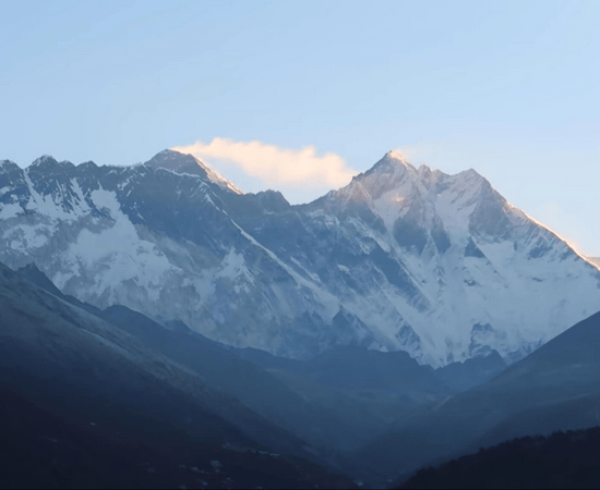
The Pin Bhaba Pass Trek takes you from the lush and vibrant Bhaba valley in Kinnaur to the The Parang La hike connects the regions of Spiti in Himachal, Tibet, and Changthang in Ladakh via a historic trading route. The beginning of the Parang La trek may be found at either the Leh settlement of Karzok or the Spiti villages of Chicham/Kibber. The path ascends to a peak at around 5,600 metres at Parang La and then follows the Pare Chu river, which originates in India, travels through Tibet, and then back into India. The ancient yet ever-changing mountain features that approximate a distinctive pattern of being submerged for a long time and housing some of the unusual fossils are the trail's major draw. There are large meadows along the path that were formerly used as grazing land for horses travelling from Spiti Valley. The highlight of the hike is a two-day stroll around Tso Moriri Lake, which is surrounded by many unclimbed hills and has a wide range of dazzling blues. One of Leh's oldest and most influential monasteries may be found in the hamlet of Karzok.
Cost Per Person
Key Highlights
- Altitude : 5880 m/ 19200 ft.
- Time : 11 Days - 10 Nights
- Region: Manali/Spiti/Ladakh
- Best Time: June to October
- Distance: 90Kms
- Grade: Extremely Difficult
Complete
Itinerary of trek
It's best to arrive in Manali the day before you're set to leave for Kaza, as this will give you time to be ready for your time away from society. The last large town or city where you can get in all the necessities is Manali, therefore today is a good day to finalise your packing list and get any last-minute necessities. Staying in Manali for at least one night is recommended for acclimatisation purposes. Get an early start on Day 1 to ensure you get in Kaza no later than 3:00 PM. Rohtang Pass and Kunzum La, home to the revered Kunzum mata mandir, will be the day's most exciting attractions. While travelling from Kunzum La to Kaza, visitors may enjoy scenic views of the Spiti River and the Key monastery in the distance. If you get there early, you may take your time strolling around Kaza's local market, which is a hive of activity from June until late October. Our hotel in Kaza is our home for the night.
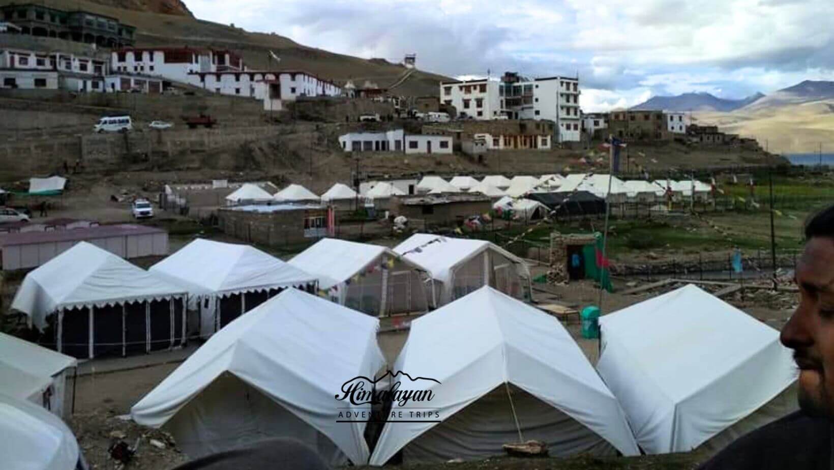
The days of today and tomorrow are set aside for acclimation. In the morning, we'll go for a short hike up a nearby hill. Walking along the Spiti riverbank after breakfast and seeing nearby Key monasteries and gompa in the afternoon are just two examples of how the days are structured to encourage physical activity. Following our time at the monastery, we will travel to the nearby town of Chicham across the historic trolley bridge. Our first night's lodging is a homestay in Chicham, the trail's launching point and a town at an elevation of 4,270 metres.
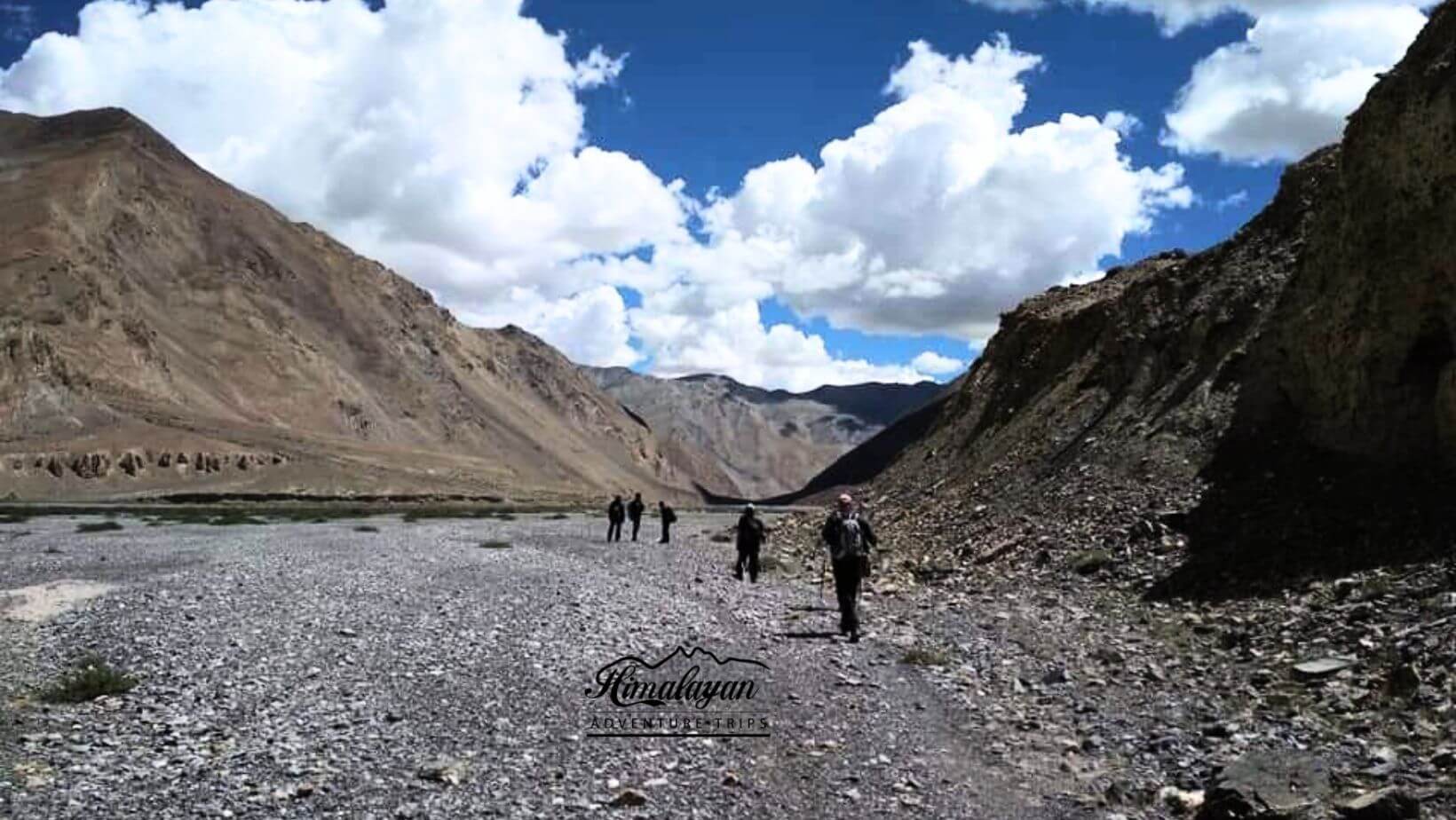
After leaving Chicham on a well-paved metallic road that has nearly no ascents, you'll find the Dumla campground in the valley to your right after about 45 minutes of hiking. With just a two- to three-hour hike from Kibber, the Dumla campground is a great choice for hikers who want to get an early start on their day. The campground is surrounded on two sides by the fertile fields of Chicham hamlet, and a creek runs through the centre. The elevation of the Dumla campground is 3890 metres. After leaving Dumla, the following three hours will be a true test of your endurance and acclimatisation as you climb steeply over terrain characteristic of Spiti. For its whole, the path is covered with Thama, a common grass or shrub, and a loose dirt and gravel surface. After a two- to three-hour climb, you'll reach a flatter, dustier area with more expansive vistas of the surrounding mountains. As you go toward Thaltak, you'll see the Kanamo peak on your right, surrounded by mountains that have lost their snow and greenery since the end of the monsoon. To get to the Thaltak campground, you'll need to hike for around 6.6 hours. This day will have a total of 636 metres of climbing and 144 metres of descending. Oasis in the midst of the desert with a breathtaking panorama of Kanamo Peak, this campground is a gem. Typical grass may be seen in this meadow, while Thama bush can be found at the campsite's edges. Camping out for the night.
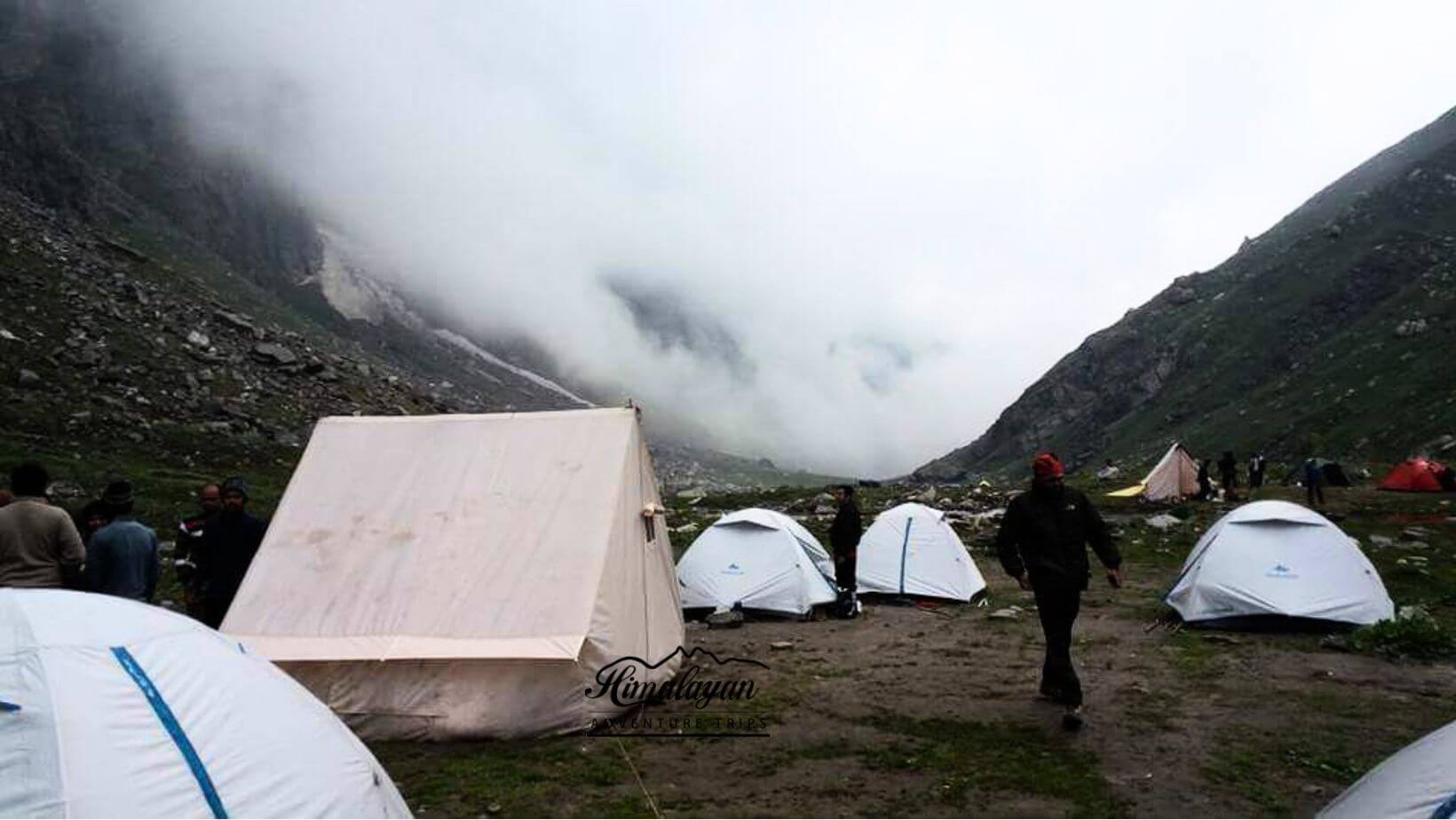
The path from Thaltak begins its descent into a deep canyon on a track constructed of loose rocks, gravels, and requires extreme caution because of the high risk of rockfall. The path descends into a narrow valley where there is no daylight. At the end of your hour and a half of steady descending, you'll reach the bottom of the valley, where the rushing river known as Rong Nala awaits. Following the river upstream, the path will be on your right. The river bends to the left after you pass the famous Rong Nala bridge and continues until you leave it at the beginning of the hike to Juktha, another stunning camping spot. The path along the riverbed consists of large boulders and smaller stones, as would be expected of any river bed in the mountains. The scree-covered climb to Jukhta is a strenuous one. The path from Jukhta progressively rises, providing a vista of the ever-eroding mountain cliffs that have become the Spiti valley's identifying feature. The day's destination is Borochen, a campground with a few water streams, perfect for small group camping after a long, arduous trek across barren and rocky terrain. Borochen camp is located at a height of 5100 m near the base of Parang La and is completely barren. We hiked a total of 12 kilometres (km), gained 857 metres (m), and lost 455 metres (m) in elevation, taking about eight hours to complete.
The pass day of any climb is challenging, but doing it at 5100 metres above sea level requires an extra measure of physical preparedness. Another great spot for a small group campout is reached after a difficult 1.5-hour ascent across moraines. The locals have given this camping area the name Thakchu because of the water stream that flows out of the rock face. Trail traces left by mules and horses provide a clear zigzag ascent to the pass. There is a hard ascent of 3.5–5 hours required to reach the summit of the Parang la. Stunning panoramas of Parilungi mountain and the Spiti and Changthang valleys can be seen from this pass. The next step is to make your way down the Parang La glacier once you've crossed the mountain. Under your feet, water is rushing at an impressive rate. While the glacier is mostly free of crevasses, extra caution is still required while travelling through it. The trip down the glacier to the Lakku camp location takes around two hours. The route continues down the glacial river, passing by the wide dry river bed on your right. Camp at Kharsa Yongma and hike for around 1.5 hours to the Parang La glacier's toe. The day's total elevation gain is 548 metres, while the total descent is 750 metres. The next campground is clearly seen from here. This camping spot, located on the river's left bank, has a reliable supply of drinkable water
Datang Nala's downstream river bed is open enough to allow travellers to pick their own path, and after nearly three hours of hiking along it and wading through numerous streams (sometimes without our shoes) we came to the campsites of Datang Yongma and Datang Kongma, which were separated by just an hour. Towards the left of the Datang Yongma camp site is where the Tsoma Nala may be found. Just below the Yongma campground, the Lasoma or Takli La nala merges with the Datang nala. The track has a total of 290 metres of elevation gain and 396 metres of loss.
After leaving Kapapuche, the path to Kitpodansa is quite identical to the one taken the day before, with just a little increase in height to contend with. The majority of the path follows the dry bed of the Pare River. Falangbado Nala is one of the river tributaries that flow into the massive Pare Chu river. The first campground, called Phalum Phada, has a large rock formation and many tiny, shallow caverns that served as a safe haven for ancient merchants. After Falangbado Nala flows into the main river, the Racholamo campground may be found at the confluence of two valleys. The Racholamo camp is located on the Lakuk Nala, a significant tributary of this river. A river bed serves as the whole path.
The path abruptly veers left, heading in the direction of Norbu Sumdo, after following the Parechu River downriver. The main challenge (or attraction) of the day is fording the raging Parechu River, where the water may reach your waist. At midday, the water rises and people must form a human chain to cross it. As the Parechu river continues its journey into Tibet, the environment changes from the desolate river bed to verdant meadows dotted with little yellow flowers and a few streams of water. Norbu Sumdo is the dividing line between the Spiti and Ladakhi regions and the entrance to Ladakh. Animals like a black wolf, a marmot, and a kiang (wild ass) appeared out of nowhere among the new, vibrant greenery. After an hour's hike, we arrive at the Chumik Shilde campground, which is surrounded by verdant meadows and has a plenty of spring water.
After a few hours of walking, you'll reach level ground and meadows. Some of the Mentok range's snow-capped summits are visible. The route leads to the lake's southernmost point, where one may receive one's first view of the pristine Tso Moriri. The campground is infamous for its herds of wild asses, and there is no reliable water supply between Chumik Shilde and Kinagdom. The day's total elevation gain was 121 metres, while the daily elevation loss was 76.
Tsomoriri lake, which is constantly to your right, provides the backdrop for this hike. Views of Chamsher Kangri and Lungser Kangri make this a spectacular hike. The elevation on the route to Korzok village is the last one you'll encounter as today is last trekking day of the whole route . For the day's hike, you'll travel 21.5 kilometres in 8 hours and 22 minutes. The daily elevation gain is 226 metres, while the daily elevation loss is 179 metres.
Get on the early shuttle to Leh. Reaching Leh should take around 5-6 hours. To book a ride from Karzok to Leh or an extended stay in Leh, please contact one of our agents (if required). You may get the same thing done for a fee.
Enquiry For Group Bookings
Guidelines
➽ Preparation for Trek
As you well know, the great Himalayan trek is one that requires careful preparation, a strategy that allows for enough flexibility to adapt to whatever challenges may arise.
Therefore, here are some things to consider before setting out on your trek:
⦿ Physically – You should start working out at least a month before signing up for a program if you want to be physically prepared for the rigours of a journey. Strengthen your legs by jogging and working out regularly to increase your stamina. To better acclimatise to the environment and increase your resilience on the walk, you should give up smoking and undertake breathing exercises twice a day. Engage in vigorous physical activity, such as playing sports, doing Yoga, or running.
⦿ Mentally –
Getting in shape physically is essential, but mental preparation is just as crucial for a successful walk. Take time to enjoy your regular activities, maintain a healthy diet and sleep schedule, and unwind before embarking on a hike. Predictions regarding the journey should not cause mental worry. Spend time with your closest pals to recharge your batteries and renew your spirit. Pre-trek preconceptions are unwarranted since the first contact with the other trekkers is certain to be a source of inspiration and energy. Conditions during the walk will contribute to the increase in mental readiness. The mental repercussions of physical disadvantages will not be ignored. So, when you hike, pay attention to different regions of your body and purposefully relax them. If you want to enjoy your hike, you should learn to loosen up a little, particularly in the hips. Think about your descent as a simple dance, and enjoy the natural rhythms that the path and your body can discover together gradually, whether you're on a flowing downhill route or a frightening slope. Try out a few new walking techniques to add some fun to your commute without worrying about getting somewhere in particular. Maintaining mental fitness mostly requires a willingness to relax and take in the journey, rather than subjecting oneself to undue stress.
⦿ Technically-
Get the right size hiking boots and go for it, from a technical standpoint. You should make use of 60 litres. To become acclimated to carrying heavy items, it is recommended to utilise a backpack on a regular basis. Get a hiking stick, a water bottle, some thermal socks, a fleece or feather coat, some long pants, a poncho, some flip-flops, and any devices you may need like a camera or a power bank (DSLR or digital camera).
Guidelines
➽ Things to Carry
- Good Trekking Boots: You need sturdy trekking boots with supportive high ankles. Don't bring your running shoes. U can carry extra floaters/flip flops also.
- Wear warm clothing, such three-layer coats, fleece upper, hollow fill or down-filled jackets. Carry full-sleeved T-shirt. Carry cotton hiking trek pants and warm pant for your lower body. Never bring shorts or jeans on a hike.
- Take top and bottom thermals with you.
- Quick dry towel with light weight and Personal toiletries. Suns cream lotion, sanitizer, tooth brush ad toothpaste, lip balm and antibacterial powder.
- Socks: Bring two pairs of regular socks and two pair of wool socks for wearing at night.
- A head torch is required.
- Sunglasses/ Goggle: UV-protected sunglasses are necessary to protect against sunlight and Snow Mountain.
- There should also be a woolen cap / balaclava, cap, neck gaiter cum face mask and warm fleece and waterproof summit gloves since it will be chilly. Keep waterproof gloves on hand since they become wet in the snow.
- Everyone taking part in the activity should have their own lunchbox, spoon, mug and water bottle/ hydration pack of 2 ltr.
- Raincoats/ponchos: Since snowfall and rain are frequent at high elevations, it is important to have one on hand so as to avoid getting wet.
- Trekking bag of 75 ltr with rain cover.
- Walking stik.
- Electronics: camera (optional) USB cable/USB solar charger, charger/earphones, Power bank fully charged.
- Personal first aid box. Emergency ration, energy bars, dry fruit, electoral/Ors
- Required Documents:
a) Registration Form
b) Medical Certificate (signed by a licensed MBBS physician)
c) NOC form (completed by the trekker)
d) 2 passport-size photos
e) ID Proof photo (not PAN)
g) Insurance upto 5 lac..
Guidelines
➽ How to Reach
By Road:
Manali's connections to the capital of Delhi are convenient. Getting to Manali from Delhi takes 12-14 hours on a bus (approx 540 KMS). Visit www.redbus.in or www.hrtc.gov.in to purchase your tickets in advance online. It's important to note that most private Volvo buses departing from Delhi depart between 5 and 8 o'clock in the evening since the trip from Delhi to Manali takes so long. Last government bus departs ISBT Kashmere Gate at 8:30 p.m. The one-way fare on a Volvo bus from Delhi to Manali is between Rs.1,200 and Rs.1,800. From Manali to the Indian capital of New Delhi: Buses depart Manali for Delhi between 4 and 8 in the evening, much as they do on the return trip. The time that you get into Delhi is a big question mark, although it may be anywhere from 6 AM to 10 AM. Only make any further travel plans after midday, and allow extra time in case the bus is late.
Route to Kasol:
From Bhunter, Kasol is just 25 kilometres away on the left bank highway, and there are buses leaving every 15 minutes. The town of bhunter may be found midway between Kullu and Manali. From Manali or Bhunter, you may either take a shared cab or take the local bus to go to Kasol.
Nearest Train Station?
Ambala (350 miles) and Chandigarh (400 km) are the closest train stations (310 kms). A helpful hint is that evening Volvo and Buses leave from Chandigarh towards Manali. To travel between Chandigarh and Manali, and back again, in a Volvo bus would cost you between Rs.800 and Rs.1,200 every sector.
Airports within a Reasonable Distance:-
The closest airport to Manali is located at Bhuntar, 52 kilometres distant. From Bhuntar to Manali, you may take a taxi for about Rs.1500-2,500. Bhuntar has frequent flights to Delhi, the capital of India. Many airlines, including Indian Airlines, Kingfisher Airlines, MDLR Airlines, and Jagson Airlines, fly from Delhi and Chandigarh to Kullu and land at this airport.
➽ Trip Cost Includes
- Conveyance within the journey.
- Tents that can be shared.
- Advanced and knowledgeable himalayan adventure trips guide.
- Cooks, helpers, and other necessary personnel.
- Vegetarian meals (breakfast, lunch, and dinner) along the journey
- Every organisational prerequisite for a journey
- First aid kit with portal oxygen.
- Camping fees and forest permits.
- All permissions for hiking.
- All meals will be supplied while on the hike. Freshly cooked meals will include a mix of indian, chinese, and continental cuisines.
- Lodging at a hotel, guest house, home, or in tents.
- All of the group's trekking equipment (tents at base camp, use of base camp facilities)
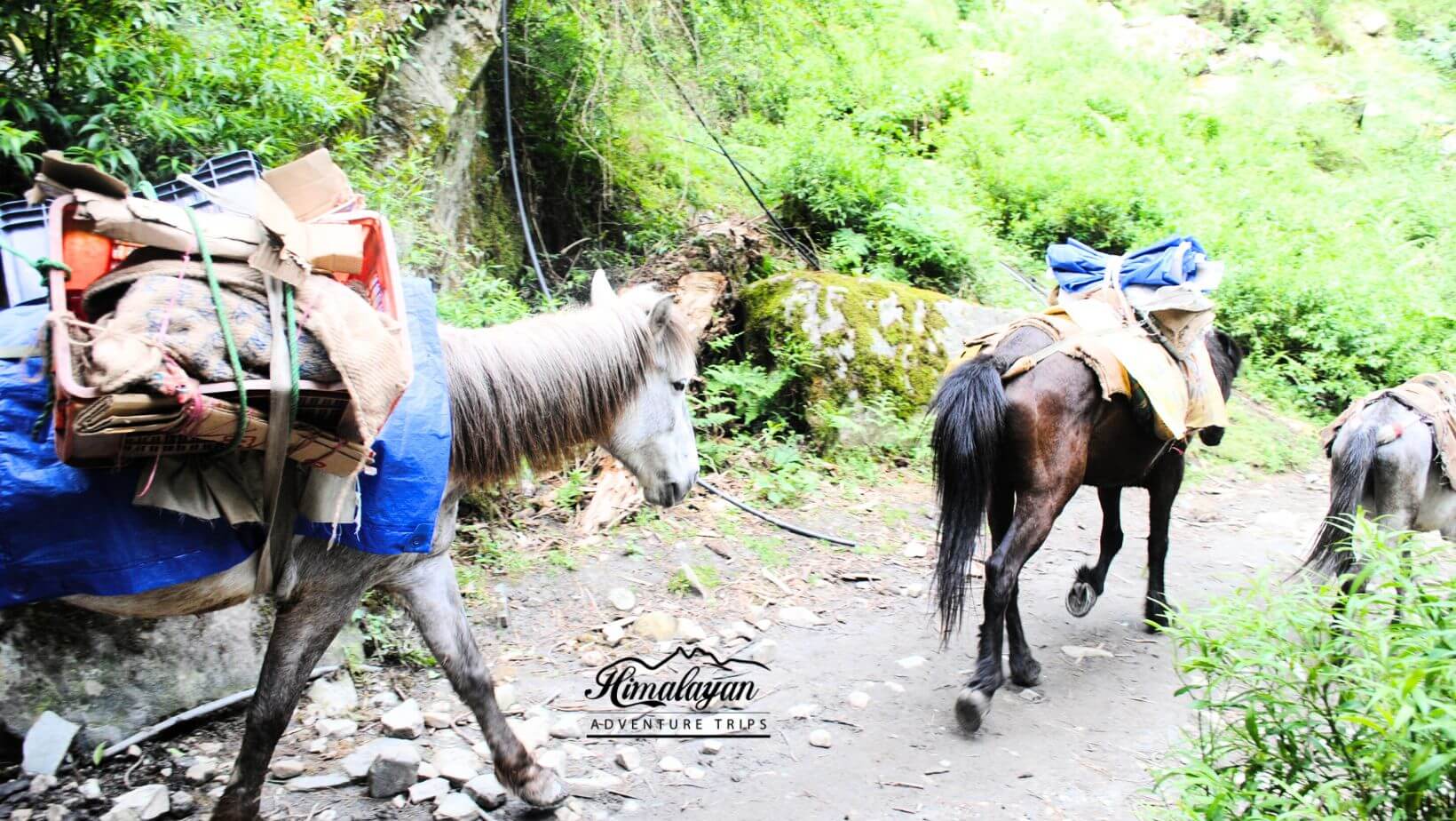
- All trip workers, including porters and mules for everyday items (such as food, tents, and utensils)
➽ Trip cost Excludes
- Airfare or other forms of transportation costs.
- Meals and hotel accommodations.
- Personal costs include washing, cell charging, and lodge showers
- Entry permits or permission for the inner line for foreign participants.
- Personal apparel and hiking supplies, such as liners for sleeping bags and walking sticks, are required.
- Any expenditures associated with rescue efforts or an early expedition departure.
- Guides and sherpa crew are tipped.
- Personal porters to carry hikers' packs
- Personal liability insurance or emergency evacuation costs
- Personal purchases (such as bottles of mineral water, bottled or canned drinks, chocolate, dried fruit, presents, etc.).
- From and to the trailhead, food.
- 5% goods and service tax (gst).
Guidelines
➽ Special Casual Leaves
Government employee can avail the benefit of special casual leave when u join us for a trekking expedition. As per the rule of the pay commission, special casual leave can be availed for up to 30 days in a calendar years for trekking and mountaineering expeditions through a register organization. Himalayan adventure trips are a register adventure tour operator register with Indian mountaineering foundation and Himachal Pradesh tourism. Candidates have to apply for leave at least 30 days before the trek/expedition start.
Testimonials
➽ Provided By The Customers
Everything about our visit to Prashar lake was better than we could have imagined. From our initial contact with Himalayan Adventure Trips, we felt their genuine interest in learning about our group's goals and expectations, and our travels with them reinforced at every turn that they not only understood our requirements but also have the acute skill and expertise to achieve them. Having already had such a wonderful experience with this firm, I will be promoting a trek to Prashar lake to all my friends who share my passion for hiking and will specifically recommend that they work with this outfit. Absolutely fantastic; I have nothing but praise for it.
Akshay Nanda
How useful was this post?
Click on a star to rate it!
Average rating 0 / 5. Vote count: 0
No votes so far! Be the first to rate this post.
")
 (1)")
 (1)")
")

